
Winter Storm Alert for St. John’s: What to Expect This Evening Into Tomorrow
Update: March 27, 2026
Newfoundland weather is all over the map this time of year. I’ve stayed home most of the week because I never quite know what I’m stepping out into – snow one minute, freezing rain the next, and then the whole mix turns to ice. We ended up with about 15 cm of snow on Tuesday, with very high winds, which shut everything down for a Snow Day. By Wednesday morning, it had all glazed over after the freezing rain moved in later that afternoon.
The past couple of days were lovely, at least according to my husband, but today we’re back to rain and about 8°C. I do have to go out, thankfully, I don’t mind the rain. It’s the wind that gets to me, and of course, we’ve got another wind warning on the go. The winds here can get pretty high!
At least it is Friday!
We have another Winter Storm heading our way this evening! I expect another Snow Day tomorrow! While I find it hard these days to travel in the snow, it doesn’t stop me from appreciating it. I enjoy watching the swirling snow!
From the Weather Network:
A developing winter storm is set to move into Eastern Newfoundland tonight, bringing a mix of heavy snow, strong winds, and reduced visibility. Travel conditions are expected to deteriorate quickly as the system intensifies overnight.
What’s Coming Our Way
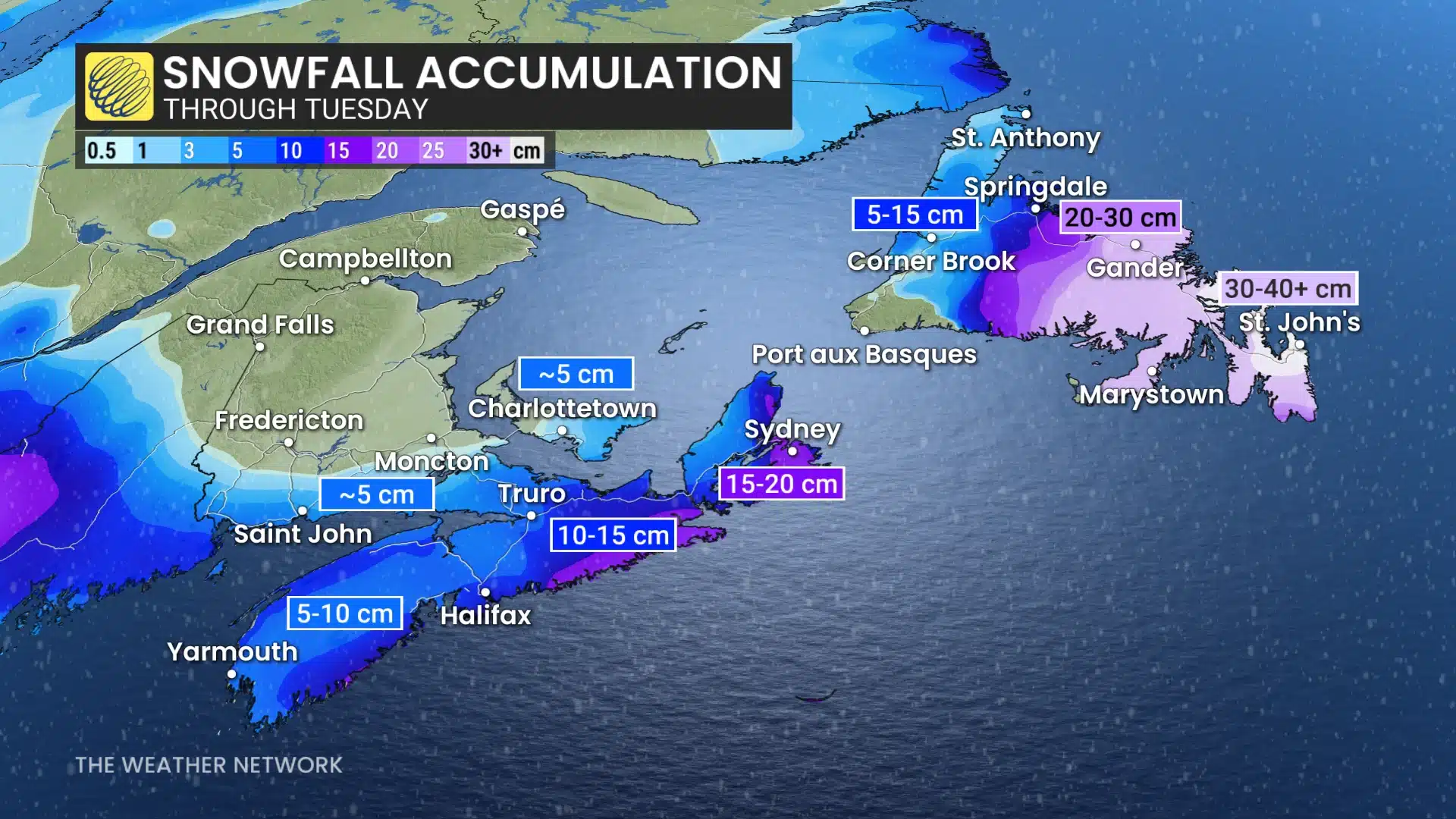
A pair of low‑pressure systems tracking up the East Coast is expected to merge, creating a potent winter storm for Atlantic Canada. While the heaviest totals are projected for parts of the Avalon and eastern regions, St. John’s is well within the zone for impactful weather.
Expected Conditions
- Snow begins this evening and intensifies overnight.
- Accumulations: Forecasts for Eastern Newfoundland suggest 15–25 cm of snow, with locally higher amounts possible depending on how the system develops.
- Winds: Gusty conditions will accompany the snowfall, with the potential for reduced visibility and near‑whiteout periods.
- Mixed precipitation: Some areas of the island are seeing freezing rain and messy conditions with this system—though St. John’s is expected to remain mostly snow‑dominant.
Travel & Safety Impacts
With snow intensifying overnight and winds strengthening, roads may become slippery and visibility poor. If you must travel:
- Give yourself extra time.
- Clear snow from your vehicle thoroughly—especially wheel wells, which can affect steering.
- Expect delays or cancellations for early‑morning commutes and services.
Staying Prepared
- Keep devices charged in case of power flickers. We have numerous battery-operated lights and power banks.
- Have salt or sand ready for walkways.
- If you’re heading out early tomorrow, plan for shovelling time—snow may be heavy and wind‑packed. I know I will be staying home till the roads and sidewalks are cleared!
Looking Ahead
The storm is expected to taper through tomorrow, but lingering flurries and gusty winds may continue to affect conditions into the afternoon. Another system is already being monitored for later in the week, as March continues its typical Newfoundland weather unpredictability.
Discover more from Stella Reddy's Story of Hope
Subscribe to get the latest posts sent to your email.

